Mapping & Modeling Services in California
GPRS Mapping & Modeling Services
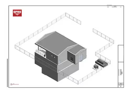
GPRS provides you with complimentary KMZ and PDF maps with every utility locate. Our in-house Mapping & Modeling Team can create anything from a simple GPS-enabled locating map of your utility locate, to highly-detailed 2D CAD drawings and 3D BIM models.
All this data is delivered quickly and securely via file sharing platforms and our new interactive infrastructure data platform: SiteMap®.
The cost of producing detailed 2D CAD drawings, maps, and 3D BIM models varies based on the scope of your project. GPRS customizes every quote to match your specific requirements and delivers fully GPS-enabled documentation through SiteMap.
At GPRS, we transform your built world into accurate, easily accessible digital data.
Facility Data ManagementMapping & MOdel Examples
Complimentary Maps

Subsurface Investigation for Storage Tanks/Anomalies


LASER SCANNING FOR CUSTOM DELIVERABLES

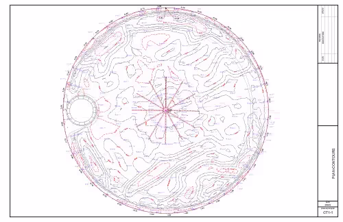


GPR ADVANCED ANALYSIS DELIVERABLES


Related Case Studies

3D Laser Scanning Delivered Critical Dimensional Analysis for Wind Turbines

3D Laser Scanning SoFi Stadium For 2022 Super Bowl Mixed Reality

Above & Below-Ground Data Capture for California School's HVAC Upgrades
